
My working theory is that nobody ever found any treasure with an illegible map. I have made these files large enough to be readable, which means that some are very large. For those of you with dial-up connections, hold the cursor over the thumbnail to see the size of the full image.
My ultimate goal is to create a map of the Philadelphia area on which map features are "clickable." For example, clicking on Pennypack Creek could lead to all my material, both text and graphics, on that watershed.
For other maps on the Web, see my LINKS page for the Library of Congress American Memory Project, Maptech's USGS Collection, and the NOAA Historical Map and Chart Collection. If you know of any other good links to high-resolution map files, especially of the Philadelphia area, please contact me.
Unless otherwise noted,
maps are from the PWD Historical Collection.
Holding the cursor over the thumbnail
will pop up the image size.
The History of Philadelphia's Watersheds and Sewers
Historical Consultant
Philadelphia Water Department

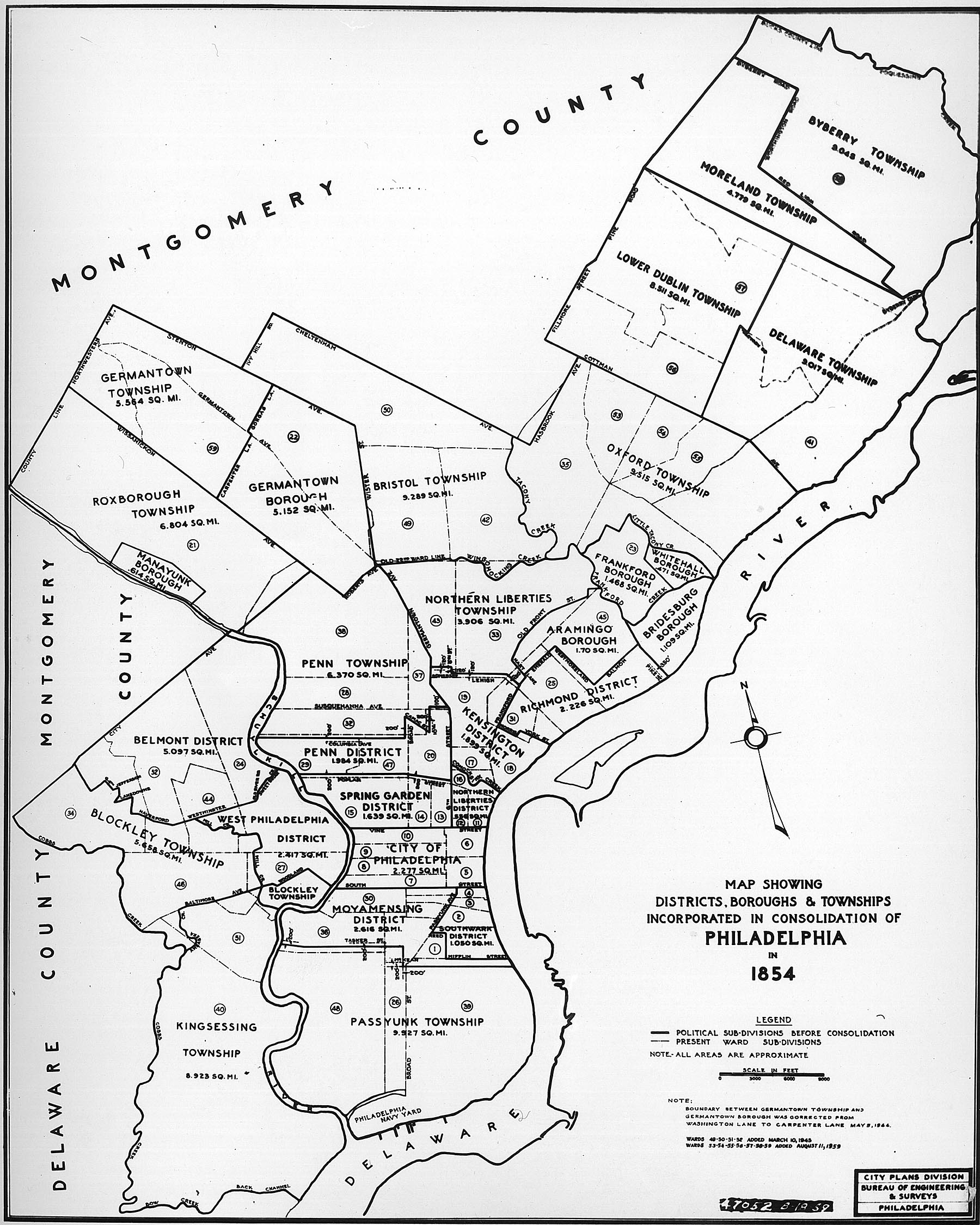
CENTER: Map showing the municipalities in Philadelphia County in 1854, which were absorbed into the City of Philadelphia under the Pennsylvania Legislature's Act of Consolidation of that year.
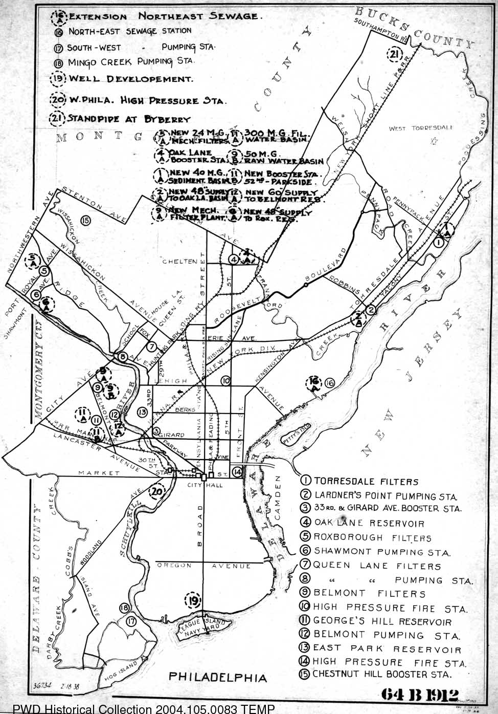
RIGHT: Map showing the major water and sewage facilities in Philadelphia, from the 1920s.
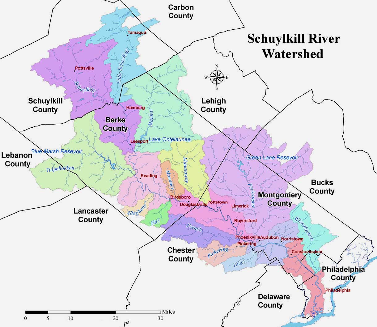
CENTER: Schuylkill River watershed today, with sub-watersheds shown in different colors.
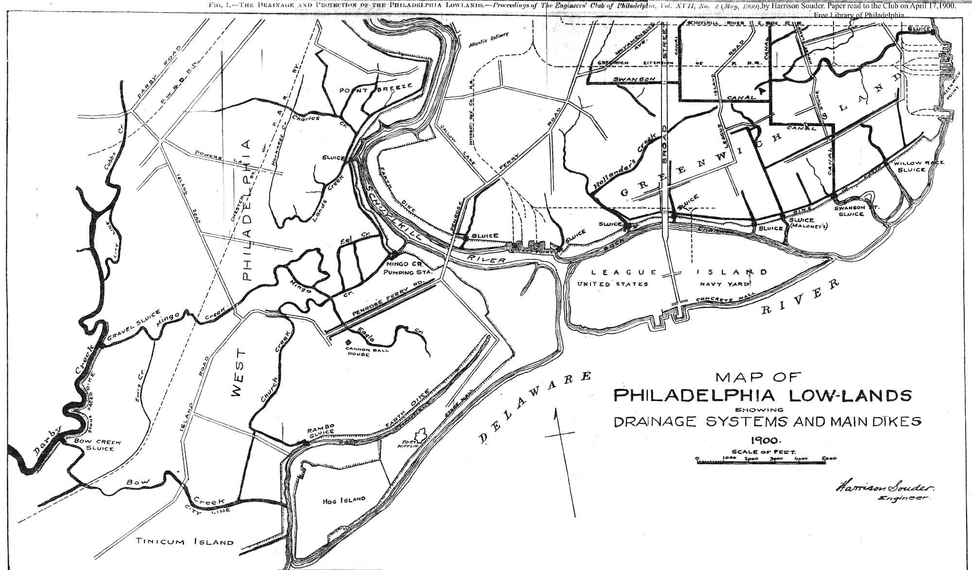
RIGHT: Southwest Philadelphia "Lowlands" in 1901, showing topography and plans for drainage, 1900. Much of this area was below the level of the high tide, and only protected from inundation by dikes, as marked on the plan.
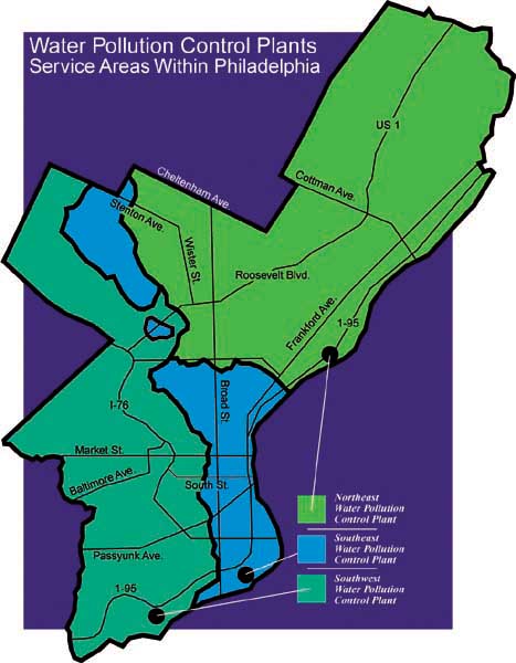
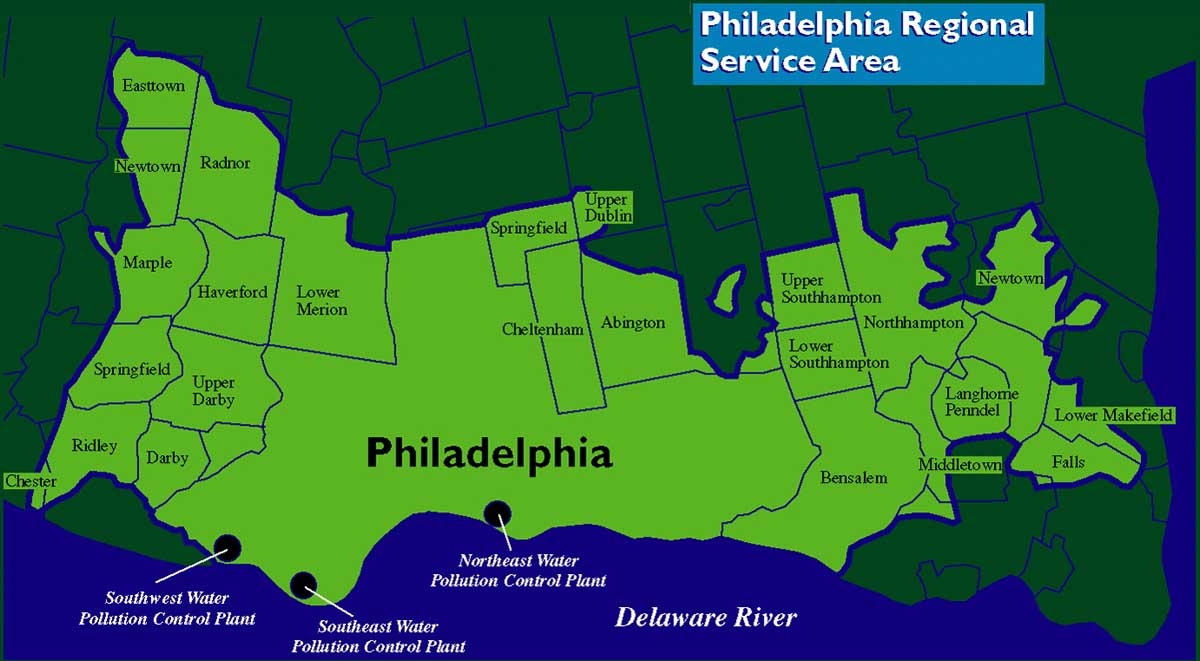
CENTER: Suburban municipalities currently using Philadelphia plants for sewage treatment.
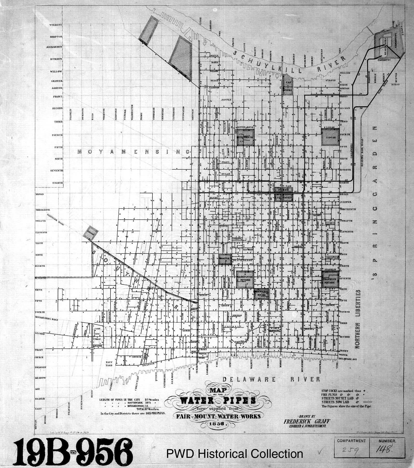
RIGHT: "Map of the water pipes now supplied from the Fairmount Water Works. 1853."
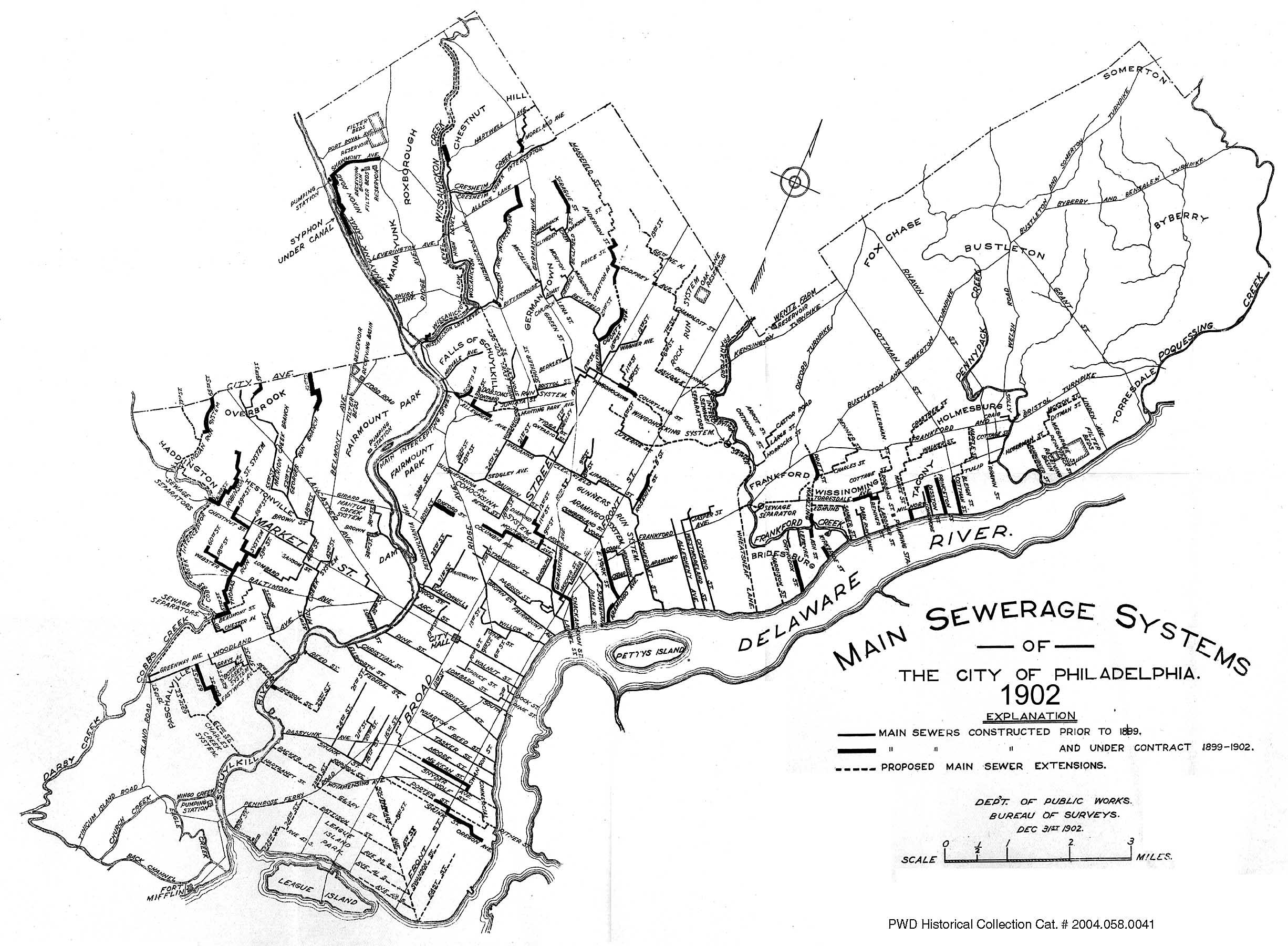
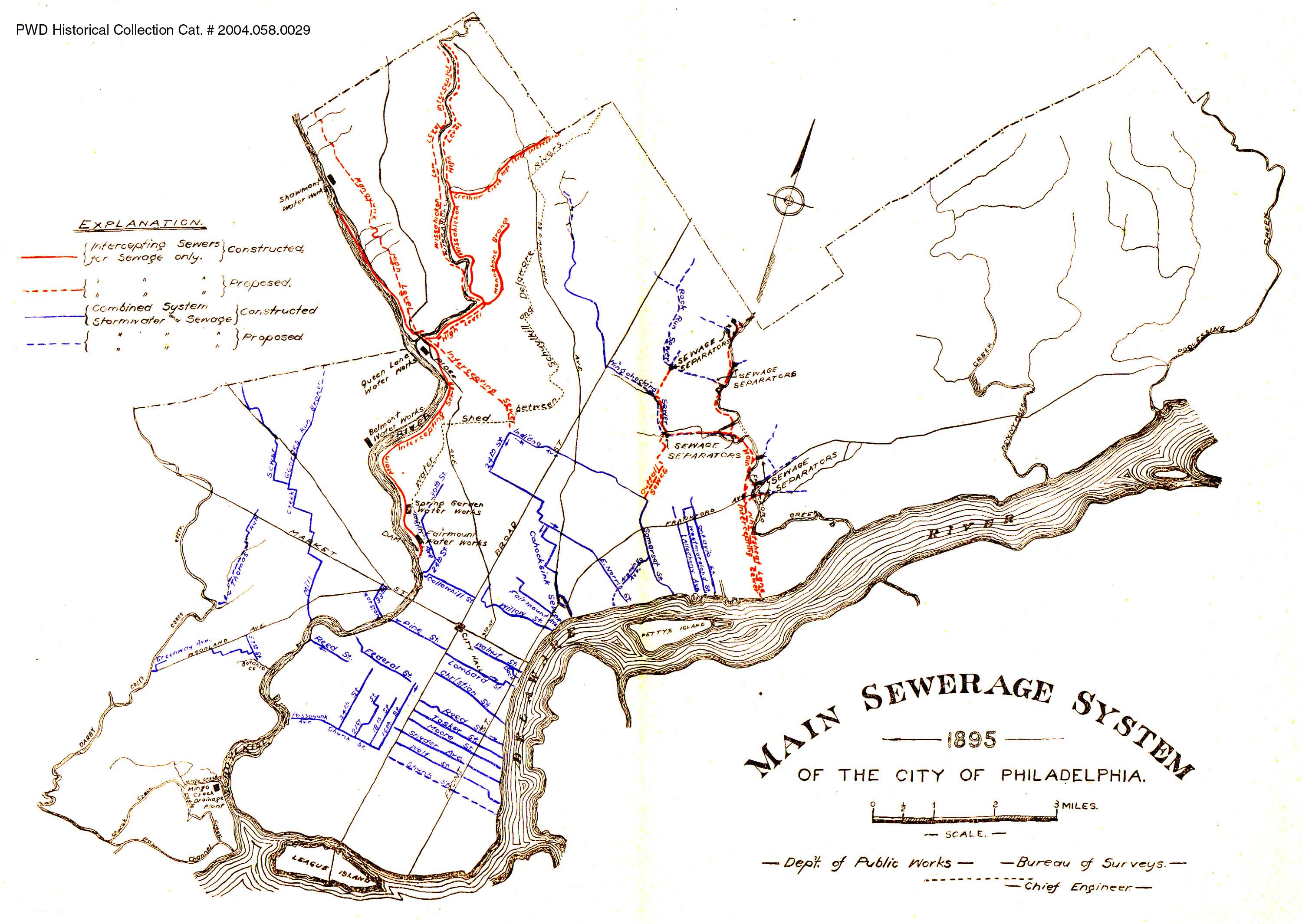
CENTER: Main Sewerage System of the City of Philadelphia. 1902. Similar maps were published in the annual report of the Bureau of Surveys/Department of Public Works annually until 1912, showing the steady growth of sewers and, by implication, of the city itself.
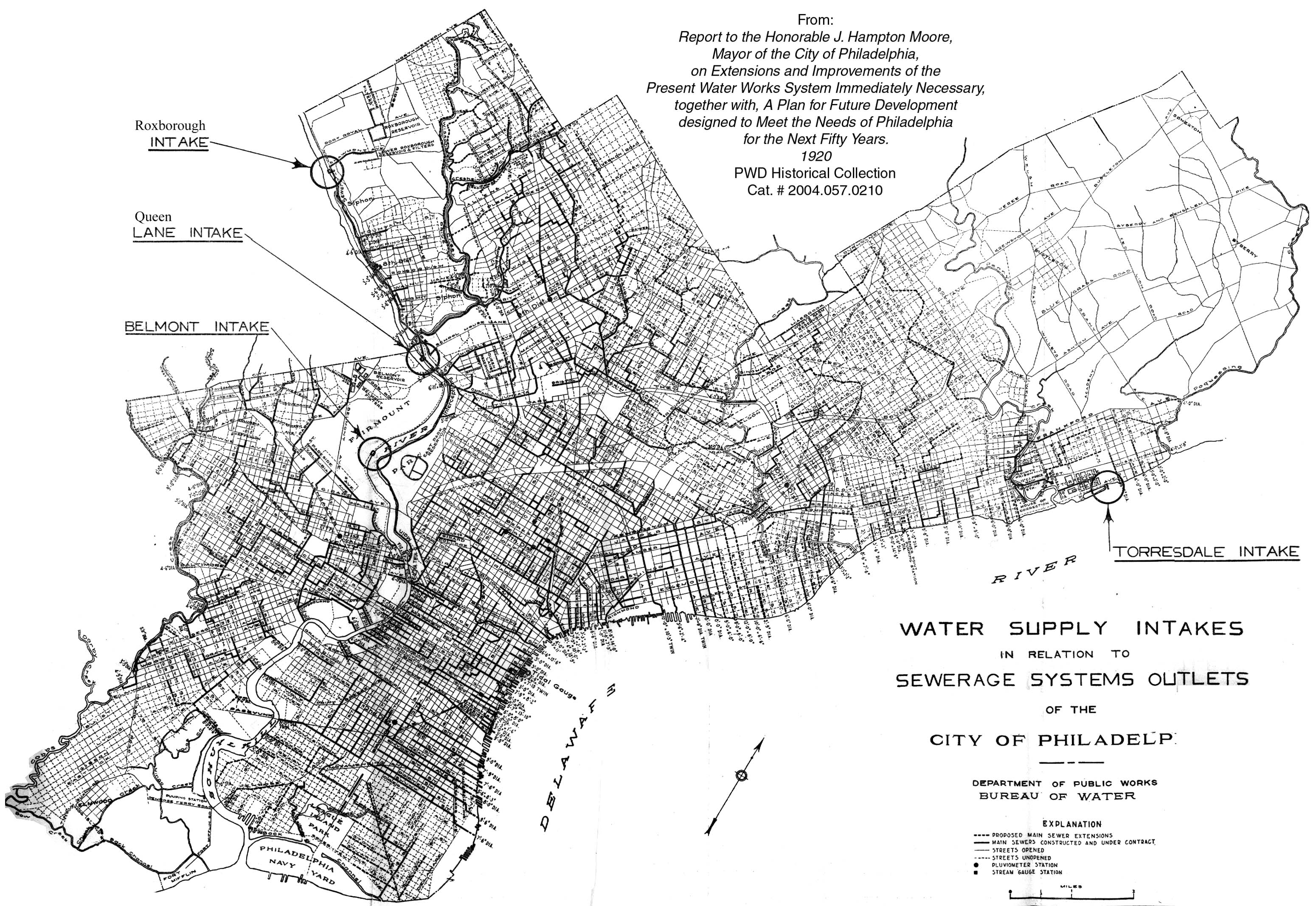
RIGHT: Water supply intakes in relation to sewerage system outlets of the City of Philadelphia. 1920. Of the hundreds of sewer outlets on this map, most were dumping raw sewage directly into the rivers and streams. The exceptions were those north of the Fairmount Dam, some along Frankford and Cobbs creeks, and some in Northeast Philadelphia, within tidal reach of the Torresdale Filters.
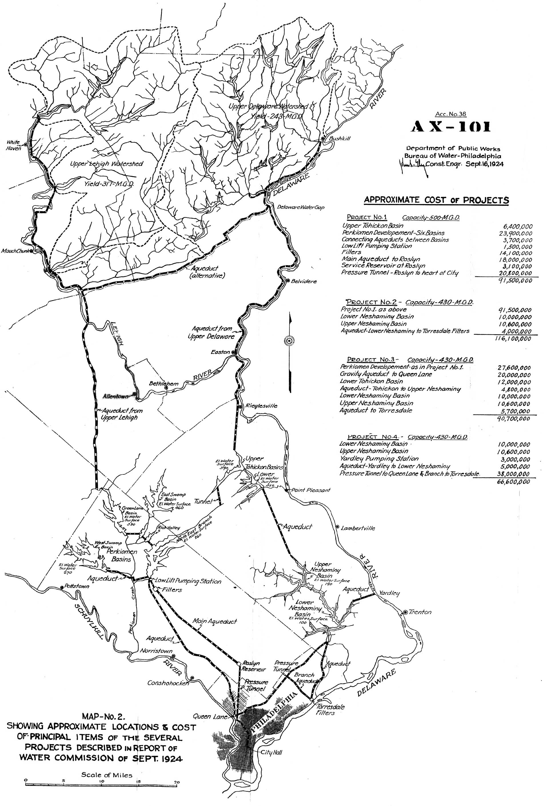
LEFT (Top): Map No. 2 showing approximate locations & cost of principal
items of the several projects described in report of Water Commission of Sept.
1924. As with the previous investigations into alternative water supply for the
city (the first in 1865, the last in 1946), this one included recommendations
for a system of reservoirs and aqueducts to supply the city with cleaner water
from the north. As with all the other investigations, City officials decided to
continue to use the polluted Schuylkill and Delaware Rivers as a water source,
depending on water filtration and chlorination to cleanse the sewage-tainted fluid.
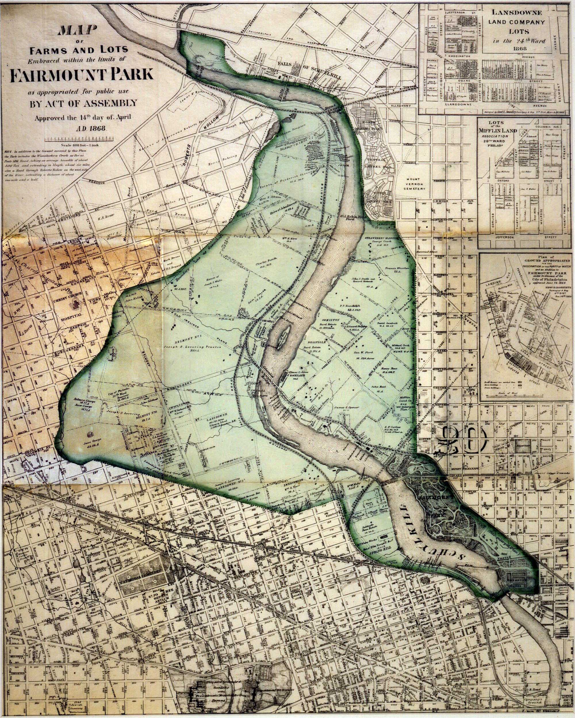
RIGHT (Top): Map of the farms and lots embraced within Fairmount Park (1868).
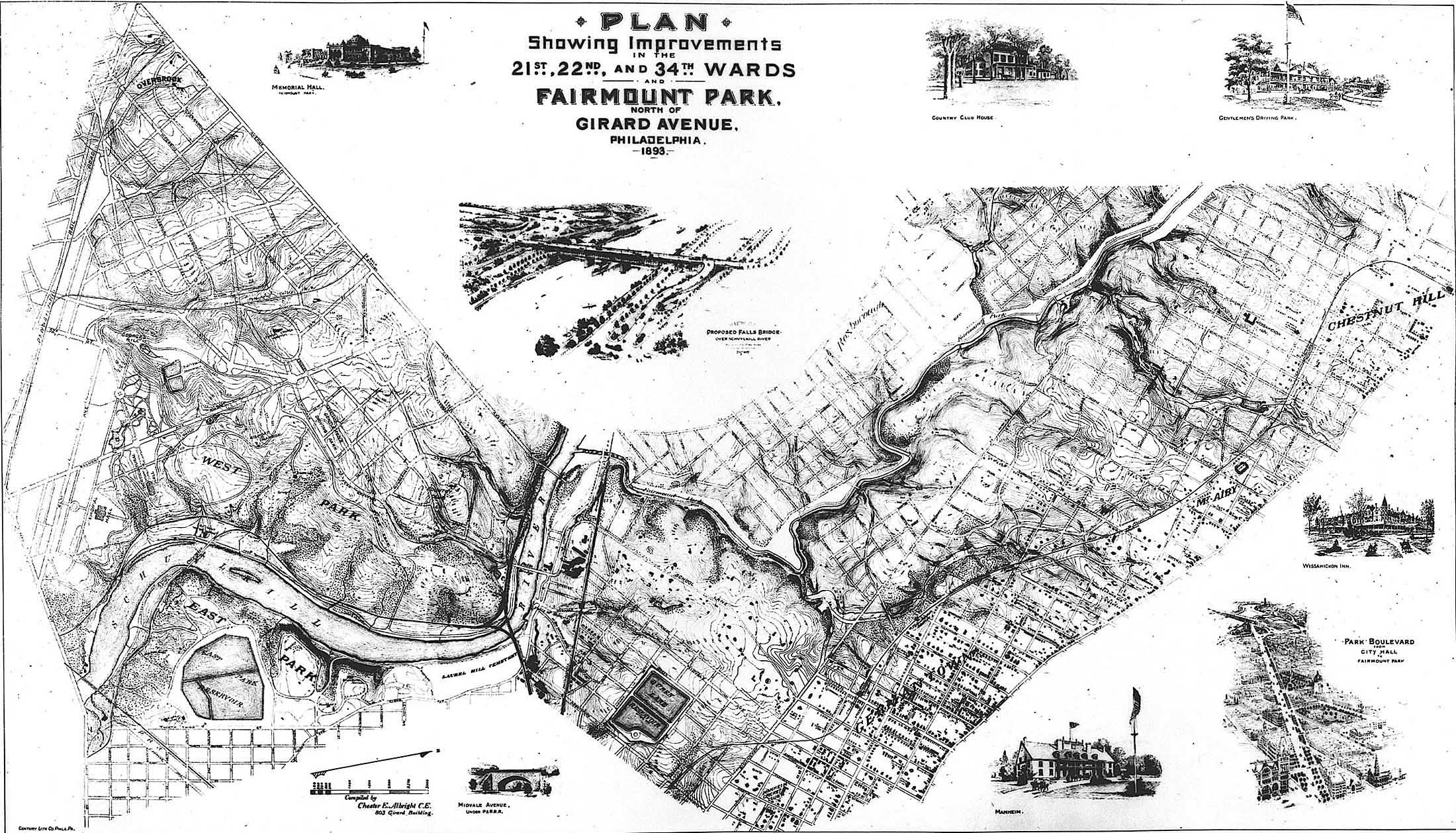
RIGHT (Center): Plan showing improvements in the 21st, 22nd and 34th
Wards, and Fairmount Park north of Girard Avenue, 1893. (City Archives of Philadelphia)
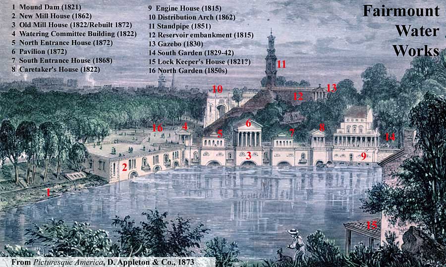
LEFT (Center): Fairmount Water Works, 1873, with buildings identified by year
of construction.
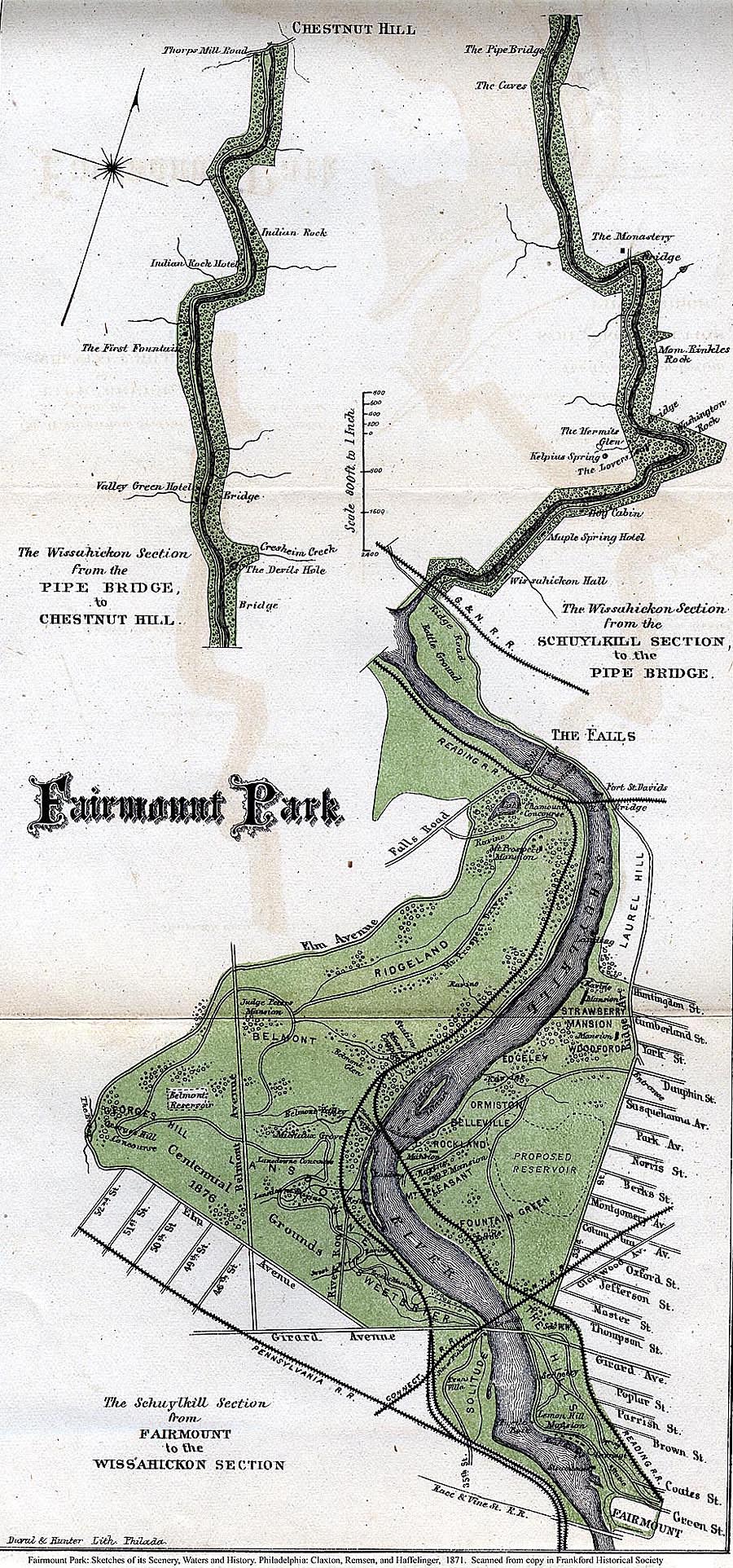
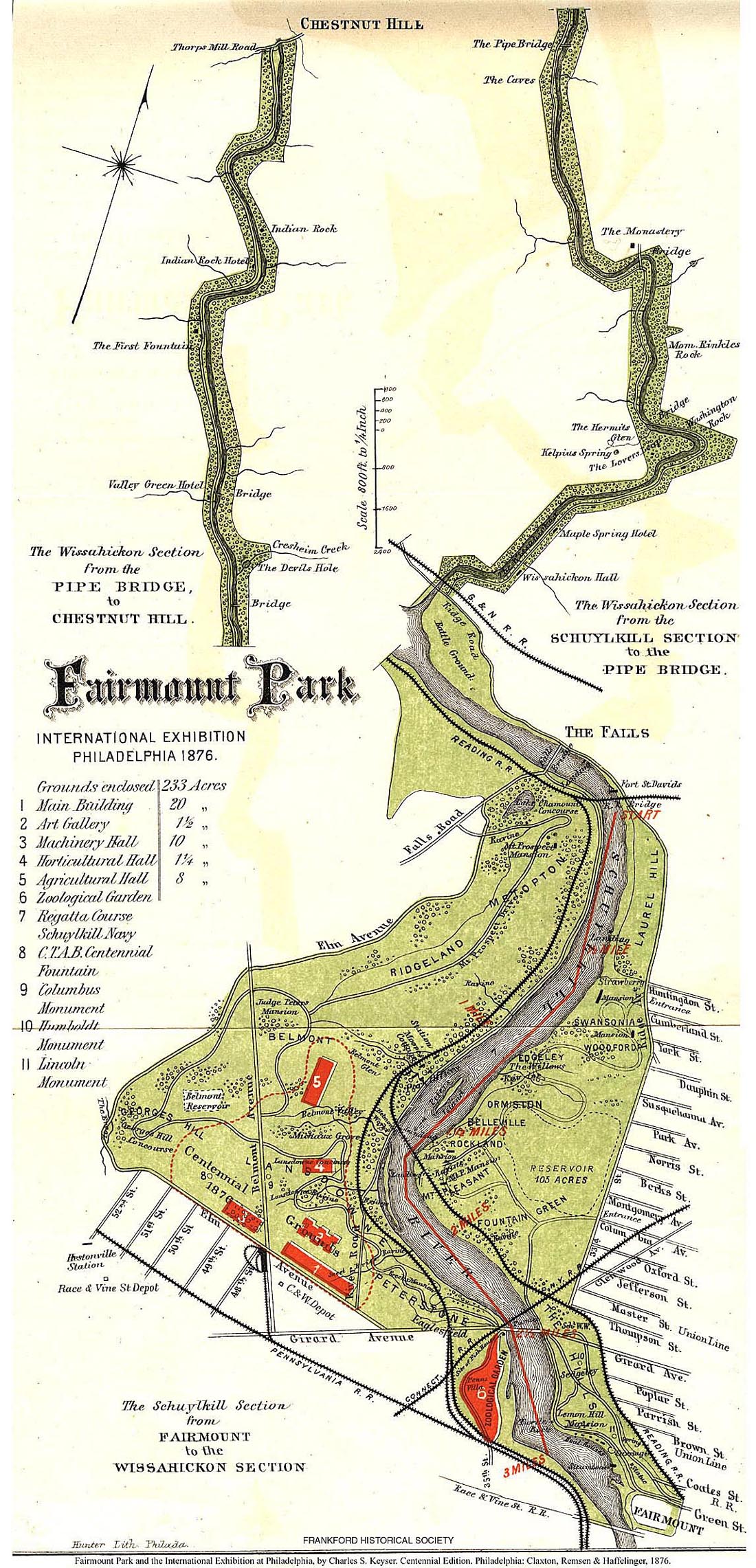
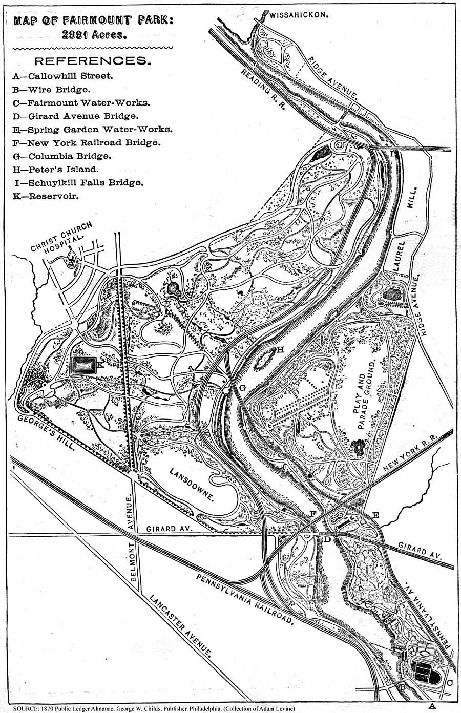
BOTTOM (Left to Right): Fairmount Park in 1871, 1870
and 1876 (Frankford Historical Society).
TO MAPS PAGE
4
(Noll Maps of Schuylkill)
TO MAPS PAGE
5
(Hopkins 1870s Township Maps)
TO
MAPS PAGE 6
(1885-1887 Water Supply Plans and Topo Maps)
TO COMPLETE PHILADELPHIA ATLASES
Back to
![]()
Website by Panacea
Design and Adam Levine
Page last modified July 15, 2008