
More maps from various collections, including my own. As on the previous page, I have made these files large enough to be readable, which means that some are very large. For those of you with dial-up connections, hold the cursor over the thumbnail to see the image size before attempting to download them.
My dream of creating a clickable map of the Philadelphia area, mentioned on the previous page, is slowly becomng a reality, due to the work of the Athenaeum of Philadelphia's "Philadelphia Architect and Buildings Survey" and the Philadelphia Geohistory Project. I will eventually add Web addresses for these to the LINKS section.
If you know of any other good links to high-resolution map files, especially of the Philadelphia area, please contact me.
Unless otherwise noted, maps are from the PWD Historical Collection.
The History of Philadelphia's Watersheds and Sewers
Historical Consultant
Philadelphia Water Department


ABOVE:
Hydrographic Survey of the Schuylkill River, 1866. For text accompanying this
map, click here.
LEFT,
ABOVE: Detail of Mitchell Map of Philadelphia, 1877, showing Schuylkill River.
LEFT,
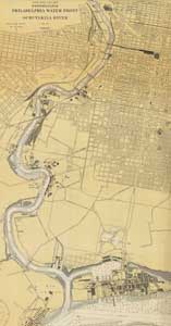
BELOW: Detail of 1923 map of the Schuylkill River from its mouth to Fairmount.
(NOAA Historical Map and Chart Collection. See my "LINKS" page for
more information.)
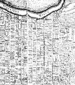
BELOW: Detail of Scot and Allardice Map of Philadelphia,
1794, showing Minnow Run, a tributary that emptied into the Schuylkill River at
about Arch Street.
ABOVE: John Hills map of Philadelphia, 1796. Note the shading that denotes the topography along the Schuylkill riverfront and elsewhere.
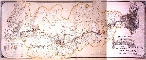
BELOW: Map of the drainage area of the Schuylkill River showing the location of pools and canals of the Schuylkill Navigation [Company]. May 1891.
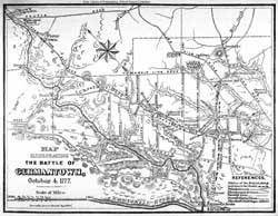

ABOVE CENTER: Map illustrating the Battle of Germantown, 1777, drawn by Spencer Bonsall, 1877. Shows Wingohocking Creek and other topographic details. (Free Library of Philadelphia, Print and Picture Collection; also in Scharf & Westcott's History of Philadelphia (1884), volume 1, at page 354)
RIGHT: Section of 1840 map of Philadelphia printed in London by the Society for the Diffusion of Useful Knowledge. (Adam Levine)
Back to
![]()
Website by Panacea
Design and Adam Levine
Page last modified January 10, 2011