Descriptions are repeated on the full-sized images, which can be accessed by clicking
the thumbnails. 20050070199.jpg
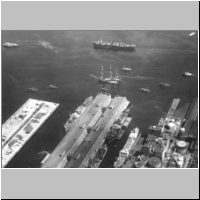
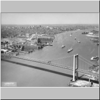
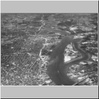
[First
published caption, 1/9/1937] A typical scene in the Port of Philadelphia, which
J. Hampton Moore says is the city's greatest wonder -- and who should know better
than that foremost exponent of inland waterways. Through this port pass the products
of one of the world's greatest industrial centres. [Second published caption,
10/13/1940] Great ports, like Philadelphia (above), might be vitally affected
by Hitler's scheme. [This photograph seems to have been taken on 2/24/1932, and
published twice, on 1/9/1937 and 10/13/1940.] Edward S. Wood, Jr. Aerial Photography.
Ardmore, Pa. 20050070200.jpg
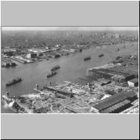
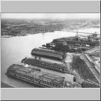
[Piers
north of Benjamin Franklin Bridge along Delaware River] 1954. Skyphotos. 20050070201.jpg
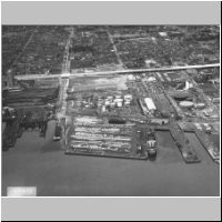
View
no. S-816 made on 2-19-55 by Skyphotos. [Ship and tugboat on Delaware River, opposite
power plant.] 20050070202.jpg
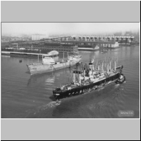
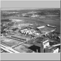
View
no. S-815 made on 2-19-55 by Skyphotos. [The 'Margarethe Honold' and second unnamed
ship near piers on the Delaware River.] 20050070203.jpg
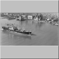
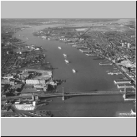
[Shipping
on Delaware River looking north, with Center City in background.] 1955. Aero Services
Corporation 20050070207.jpg
Walt
Whitman Bridge. [Delaware River, looking north with Center City in background]
View No. S-785-4 made on April 1959 by Skyphotos. [Tighter crop than 2005.007.0208] 20050070208.jpg
Walt
Whitman Bridge looking north. [Delaware River, with Center City in background]
View No. S-785-4 date 1959 by Skyphotos. [Wider view than 2005.007.0207] 20050070211.jpg
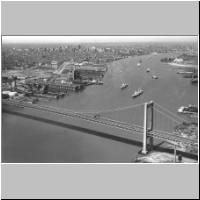
Ben
Franklin Bridge looking south. View No. 20 date June 1963 by Skyphotos. [View
shows Philadelphia and New Jersey sides of Delaware River] 20050070212.jpg
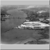
106
acre site just south of DelAir Railroad Bridge [along the Delaware River on the
New Jersey side. Site was used as depository for material dredged from river.]
1964 ca. 20050070213.jpg
[Delaware
River looking north from South Philadelphia to Benjamin Franklin Bridge. Philadelphia
and Camden.] 1964 ca. 20050070215.jpg
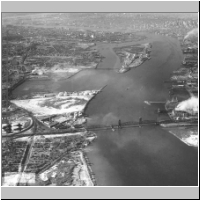
Looking
up [Delaware] River. Benjamin Franklin Bridge in foreground. [Petty's Island].
View No. S-1379-11 Date July 1 1965 by Skyphotos. 20050070216.jpg
[Delaware
River scene: South Philadelphia piers, Walt Whitman Bridge, New Jersey in background]
1966. Skyphotos. 20050070217.jpg
[Delaware
River: Port Richmond at left, and terminals at foot of Allegheny Avenue] 1967.
Skyphotos. 20050070218.jpg
[Delaware
River: Port Richmond at right, and terminals at foot of Allegheny Avenue, New
Jersey in background] 1968. Skyphotos. 20050070245.jpg
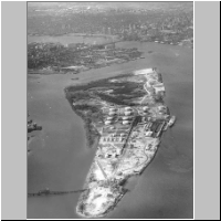
Most
used and most familiar of all the Delaware's islands is Petty's, now a thriving
400-acre industrial area across from Port Richmond. [Published caption] [Delaware
River] [It is unclear when this photograph was taken. One date stamp on the back
is "Apr 26 1948," though the wintriness of the scene would have been
unlikely in April.] 20050070246.jpg
Petty's
Island--private industrial property in Pennsauken township--increased in value
from 500 guilders ($240) to more than $1 million in 300 years. 1967. Skyphotos. 20050070247.jpg
Petty's
Island May Be Site. Bicentennial plant propos[ed for] island in the Delaware River.
[Published caption] View No. S-1004-19 Date Oct 31 1966 by Skyphotos. TO
TOP OF PAGE Return
to Delaware River Images Main Page Back
to

Website by Panacea
Design and Adam Levine
Page
last modified March 8, 2006 |